2. ELECTROMAGNETIC OBSERVATIONS
2.3 PROMPT g-RAY EMISSION
2.3.2 SPATIAL LOCALIZATION
Canonically, the spatial localizations of GRBs are given in second equatorial coordinates, i.e. right ascension (RA or a) and declination (DEC or d), as illustrated in figure 2.3.2.1. Declination (-90 degrees ≤ d ≤ +90 degrees) is measured with respect the celestial equator. Right ascension is measured with respect to the vernal (spring) equinox, i.e. the ascending node of the ecliptic and the celestial equator, and is measured eastward along the celestial equator to the foot of the hour circle of the celestial object. The vernal equinox is also referred to as the First point of Aries and functions as the zero point of right ascension. Due to the diurnal rotation of the Earth (24h = 360 degrees), right ascension may be expressed in either degrees or hours:
![]()
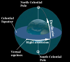
FIGURE 2.3.2.1: Second equatorial coordinate system.
Rotational effects such as precession and nutation, coupled with the proper motion of stars, require a dynamic inertial reference frame, defined by a fundamental star catalog. Hence, a reference epoch is used to define the mean equinox of date for a given star catalog. As previoulsy discussed, current reference epoch is J2000.0 and the relevant start catalog is FK6. The localization coordinates are usually accompanied by either a total positional error radius (sR) or, in the case of different uncertainty along azimuthal and zenith coordinates, an error ellipse.
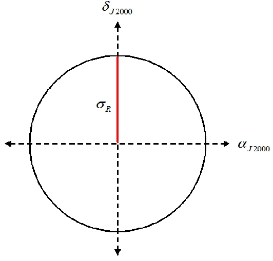
FIGURE 2.3.2.2: Visualization of total positional error radius sR.
Since the statistical and systematic errors are uncorrelated, sR, illustrated in figure 2.3.2.2, is defined as follows:
The spatial localization for GRB030329 was given as aJ2000 = 10h44m49s, dJ2000 = +21o28'44" (SXC-Notice). However, this was later revised to aJ2000 = 10h44m50s, dJ2000 = +21o30'54" [SXC-Ground, (Vanderspek et al. 2003)]. Both positions were centered about a 2" error circle as illustrated in figure 2.3.2.3. Other localizations followed based upon optical (OT) and radio afterglow emissions. The most precise localization, used in this analysis, was based upon observations of the radio afterglow, which are discussed later.
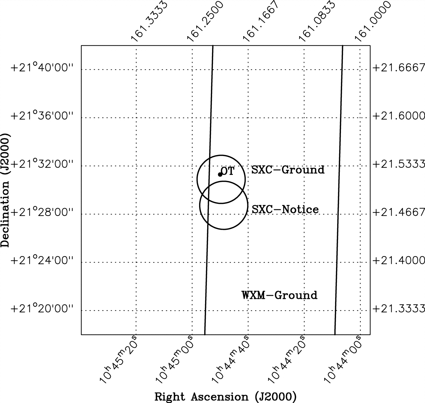
FIGURE 2.3.2.3: Localization of GRB030329 in second equatorial coordinates (Vanderspek et al. 2004). The band indicates 12' x 2.25 degree WXM error while the SXC positional error radii are 2'. Note that the location of the optical transient (OT), an associated afterglow emission of GRB030329, is within the SXC-Ground localization, which includes corrections for systematical errors in SXC-Notice. The above localization was consistent with the IPN annulus (not shown).